Monday, September 12, 2016

Sunday, September 11, 2016 Osceola, really? Ely, really...


Sunday, September 11, 2016

This morning, my paternal human took me outside first thing.  I got to roll and sniff.  My trick from yesterday worked.  They are so easy to manipulate.

Last night's astronomy presentation was interesting.  The Great Basin is certified as a 'dark' location.  It is actually one of the best locations in the country to view the stars.  Even though there was a half moon last night, we could still see the milky way.  They had telescopes set up.  We viewed Saturn as it is tilted on its axis so you could really see the rings.

For this morning, our hike took us on a foot path up to the Upper Lehman campground.  There are two directions in this park.  Up and down.  So, up we went meandering by a creek.  The campground is being renovated and is quite nice.  There are a few spots RVs could fit in, but it is geared - as they all are - to tent campers and small rigs.   There were a bunch of people bird watching, but other than that, the place is deserted.
The view from Upper Lehman


We decided to check out the town of Ely, about 65 miles from here.  There is the Osceola ghost town on the way, so off we go.  I am driving.  When we turn onto the road to Osceola, it is a dirt road about 7 miles back.  Most of it has been graded in the last decade so it isn't bad.  The last mile or so is a bit bumpy.  We have our route in Samantha and we see an old building behind a locked gate.  About 500 feet later, she tells us we have reached our destination on the left.  It is a bush.  But the building we passed is not accessible.  Is that it?  We drove 7 miles off road for a single building we can't go look at?  We see a couple of workers and they said a fire wiped out the other buildings and this was about it.  But instead of retracing our steps, he said the road goes to the highway in about 4 miles.  So we continue on.

Then Samantha tells us to turn left.  We look ahead at the road and we are thinking that this looks like the right way.  But she knows where we are, right?  So, like a couple of idiots, we put our trust in this psycho bitch and turn left.  The road is smaller and rougher and there is a dropoff on the right.  My hands are sweating.  Of course, Spouse has to tell me how to drive.  'You are getting too close to this edge, the shoulder might collapse.'  'Spouse, I am hugging the hill on my side, I can't move any more to the left'.  Hah!  Now he knows how I feel when he is driving, especially when he 'Doug's the curb'.  It is getting ridiculous.  This can't be right.  Spouse is bitching, like I could do something about it.  There is no place to turn around.  I finally told him he could drive and we switched places.  Within a minute, the road got a bit better, but where is it going?  Samantha dumped us a few miles ago. She has no idea where we are.  Another fork in the road... great.  Oh well, let's take the lower one.  We finally see the highway way out yonder.  There is hope!  We follow the road, twisting and turning.  Then as we see we are heading towards the highway, Samantha comes on and tells us to turn left in one mile, like she has been there all along!  She can't be trusted on dirt roads...

Back on to 50 - the loneliest road in the country.  There is no traffic.  It is high desert with hills and mountains, so it is quite pretty.  We climb the Connors pass and follow the hills and valleys past a prison that we don't see.  The 'No Hitchhiker' signs are prominently posted.

Ely is a mountainish town.  There is the old side of town, with a couple of small old casinos and storefronts.  But it is Sunday, and everything is closed.  We are essentially all alone.  We cruise the town on the other side looking for a place to eat.  We stop at a small casino where we had a good meal, and gambled just a tad - broke even.  We asked if it is always this deserted and we were told yes! 

We stopped at the grocery store for a few things.  Lots of hunters in camo.  The few I talked to were not happy that they hadn't bagged any deer.  RUN BAMBI RUN!

Got back to a little rain.  No campfire tonite!

Saturday, September 10, 2016 The Bristlecone Forest


Saturday, September 10, 2016

What gives?  My humans are not letting me out when I beg them!  They are IGNORING me!  I will teach them.  I will go lay on the bed and give them stinkeye.  My maternal human came and rubbed my belly and I didn't even turn on my purr box.  I will teach them...

This morning's walk was actually a hike.  There is a 12 mile scenic drive up the mountain to a series of trailheads.  Our campsite is at about 7300 feet.  The trailheads start at about 10,000 feet.  If you hike to the Mt. Wheeler summit, you will be at 13,000 feet.  We opted for the Bristlecone trail.

We packed a lunch and started the ascent.  It is a soft forest path, then there are lots of rocks.  It is fairly easy, but any time you start at 10,000 feet, you need to go slow.  Altitude sickness is no fun and we wanted to enjoy the day.  It is a forested trail with scenic vistas of the Snake Valley below.  The Snake Valley looks so much prettier from up here.  The surrounding mountains are covered in pines and aspens in various stages of fall colors.  It is absolutely beautiful.  The temperature is probably in the 60's which is quite comfortable for hiking.

It is about a mile and a half up the trail to the bristlecones.  This forest has trees over 3000 years old that are still alive.  They live in harsh conditions - sometimes no water, brutal winds, snow.  They grow in amazing twists and turns.  I would love to mount orchids and tillandsias on these puppies!  Even ones they think are dead, turn out to send up new growths.  They are incredible specimens of the test of time.


Continuing on, we hiked to the glacier overlook.  As a rock hound, I didn't know if I was in hog heaven or the depths of hell.  We are hiking in a glacial moraine where gazillions of rocks have been pushed aside for the glacier to do what it has to do.  These rocks, actually boulders, are fabulous!  I can see every one of them in the lapidary shop, except for one thing...  They are huge!  Can I sneak one into Spouse's backpack?  Do you think he would notice this tiny 100 pounder?  As it was, I put a few in my backpack and my waistpack. Then we get to hike down...  over the rocks... over the tree roots... with rocks hanging all over my body.  Definitely an 'I Love Lucy' moment...  We did take a little side trip to look at Teresa Lake.  Or should I say pond...  When I got back to Jack and took off my pack, I had trouble walking. My legs didn't know what to do without the extra weight of the rocks!  It was pretty weird!  Who knows what will become of these rocks, but for now, they are mine.  Shhhh, don't tell anybody...

Tonite, we are going to the astronomy presentation at the visitor center.


Friday, September 9, 2016 The Great Basin and the Lehman Caves


Friday, September 9, 2016
When I am in the little house that moves, I sleep.  I slept a lot yesterday.
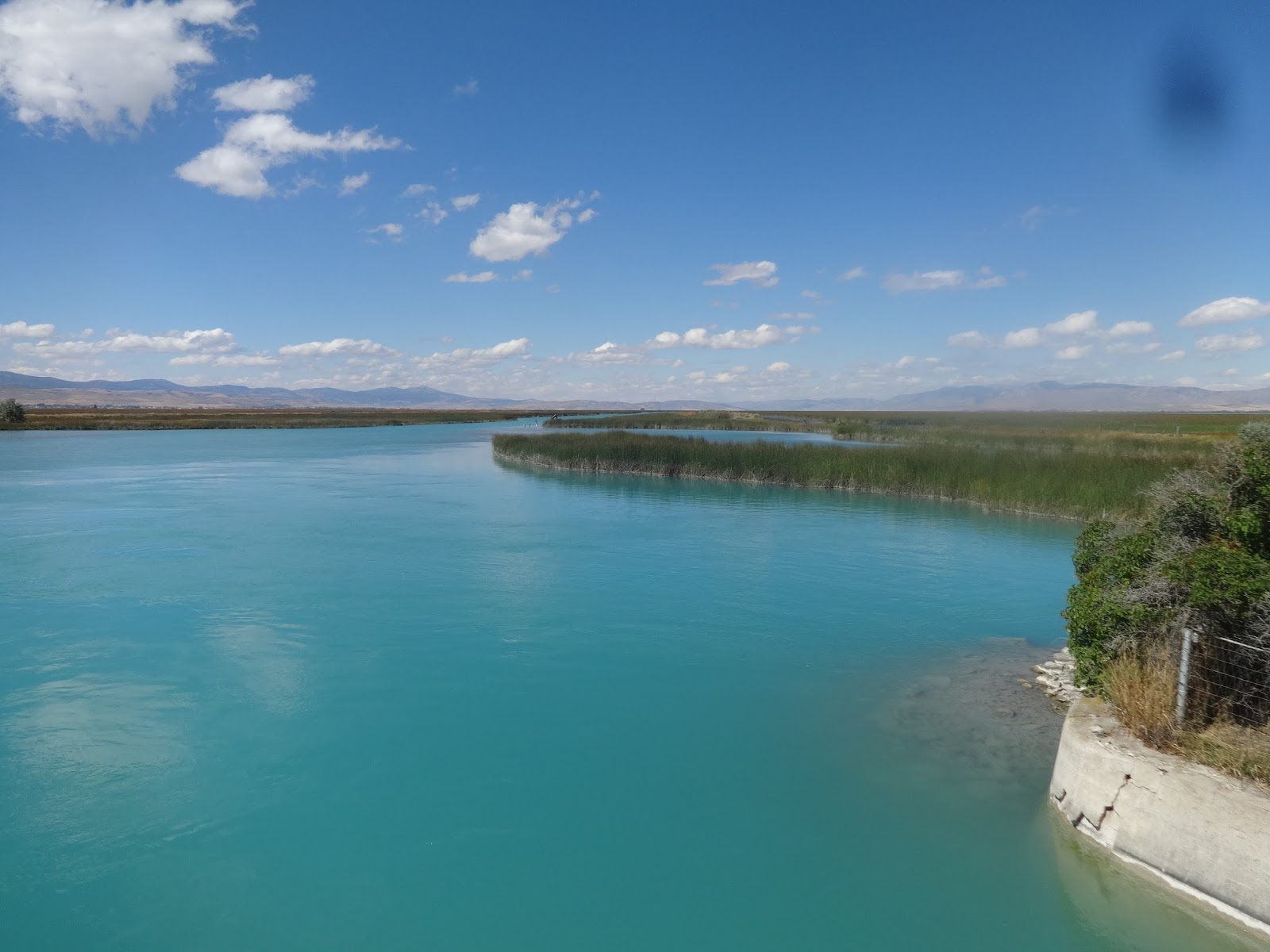
Our morning walk took us through a farm with soy and corn.  We can see mountains on the horizon.  Spouse heads back and I keep walking.  I come upon a huge river, I think the Sevier.   It is big enough to have navigation buoys on it. 

I have cleaned my camera lens... 3 days later!

Getting back, we ready Hannah for her trip to the Great Basin.  Let's face it... once we get past the few farms in Delta, the ride is downright boring.  We are headed to Baker, Nevada.  It looks like we could be driving to Baker, California.   It is brown and boring.  At one point, we see the Sevier Lake Bed.  White and boring.  We come upon a mountain pass.  YAY!  After a few miles of that - the summit being 6280 feet - we dip back into a boring valley - the Snake Valley.  A hundred miles later, we get to Baker.    The only thing it's got going for it is that it is at the base of the Great Basin.
We stop at the Visitor Center and get a map and get RV recommendations.  They point us to the lower Lehman campground.  And did we get there in the nick of time.  A flock of wild turkeys greeted us upon our arrival.  There are only a handful of sites - all of them cozy for RVs.  Our living room slider has some thorny bush hugging it right now!  But we have a creek running through our site.  It isn't the most level site we have ever had, but suitable nonetheless. No sooner do we set up when other RVs come cruising through... the water sites are taken, and within a few minutes, the other sites were taken too.  I wonder if this is a weekend thing.  We are so far from anywhere, do people come here for the weekend?
I had been happy to put shorts back on, but now, it is borderline cool/warm.  We head out to tour the Lehman Caves.  Ok, I am not part bat... caves are not what I hunt out, but when they are there, I go see them.  And this cave was well worth seeing!  The formations inside were beyond fabulous!  None of the vandalism that we saw in the Minnetonka cave earlier in the week.  This cave was incredible.  My neck is sore from looking up, then over my shoulder.  I kept bumping into people as I turned around to see things from the other side.  Columns, stalagmites, stalagtites, heliotites, bacon, curtains, popcorn, shields... So much of it was in pristine condition, it was overwhelming. Randi ranger was a little too perky for me, but she gave a good tour.  This was truly a treat.  We weaved our way through narrow corridors.  We had to duck our heads.  There were growths in every crack and crevasse.  The only down side was that I followed Spouse up the stairs at one point while he was farting all the way... It could have cleared out the entire cave... The noxious cloud followed him...  I ditched him!


Afterwards, we went exploring the Grey Cliffs area.  You got it... named after the grey cliffs in the area.  There are some caves that are supposedly closed... Do we call on our inner bats and explore them while we are here?   hmmmm...

We continued on the dirt road past the caves and the trail head... past a family of mule deer... past the boundary of the national park... ok, what have we got us into this time?  Which fork in the road do we make?  We ended up at somebody's ranch with a closed gate... not going to do us much good... Can we go back so I can have my vodka tonic?  And that is what we did.
Vodka tonic and a campfire... All is good!  And what a night sky!

Thursday, September 8, 2016 Too many highways to count


Thursday, September 8, 2016

ME-OWT!  I will make sure my humans cannot ignore me.  I will paw at them.  I will sit in their food.  ME-OWT!  My paternal human lets me lick this ice cold thing on a stick.  I will be in their faces until they let ME-OWT!

It is cold.  Well, we are at a ski resort at 8000 feet, so it should not come as a surprise that it gets cold even though the calendar still says it is summer.  I watched deer cruise the parking lot last night, and oh what a night sky!  Although this place is not my style for an RV park, I love the location and the fact that we are essentially all alone, except for the workers starting to get the mountain ready for ski season.

After my walk, we ready Hannah for her next adventure.  We decided to go back to take a round about way to get to Ogden by going to Bear Lake, Garden City to be exact, and catch 30 going south, to 16 to 39.

As we go south along Bear Lake, more road kill.  We saw a lot of road kill including a dead coyote right next to a dead deer.   I wonder what that story was all about...  As we go south, the mountains become more arid.  We climb a bit and as we leave the lake and turn through the mountains, we are in the middle of the high desert.  For miles, it looks like we could be driving up to Mammoth.  As we get near Randolph, there are a few farms and cattle ranches.  We turn on 16 passing some more farms and more high desert.  We are starting to see Utah's famous red rock beneath the desert sage and ponderosa pines.  Turning on to 39, we climb. 

We are not in rugged mountains.  The pass goes to 9000 feet, but they are giant rolling hills, meadow mountains if you will.  And it is a stunningly beautiful pass.  The valleys are not flat valleys but rolling hills with various colors and textures, overlapping one another.  A swath of pines, with a patch of brown, then a ribbon of aspens.  The undergrowth is in various stages of fall color regalia.  There are miles and miles of aspens.


We see a hunter in camo with a bow.  It looks like there are hunter camps on some of the back roads where we can see through the trees.  As we descend, we check out a few campgrounds along a creek.  Hannah could fit in a few spots.  It is very pretty.  We come out near I84 at the Snow Basin ski area. 

We try to stay off major highways, but there is no way to avoid it where we are going.  I84 west to 89 south, to I15 south, to I215 south, to I80 west, to 36 south.  I know you are thinking, where the hell are they going?  We are headed to the Great Basin national park in Nevada, right across the Utah border.  We heard it was worth seeing so...  it is kind of not too far out of our way, sort of, maybe.  We have another week before we need to be in St. George, so this looks like it should work, right?  Supposedly, the ride along I80 at this point is scenic.  It does go along the Great Salt Lake, but it looks Nevada brown to me. 

Once we turn south on 36, there are some decent size towns.  We stop for a bite.  I check out the campground situation...  Huh?  There aren't any... at least any that will take an RV.  Really?  I check, I check, I check...  The next place we can stay is in Delta, 98 miles south.  Oh well, we have gone longer than we like to go, but we should be there by about 4:30.

The road is boring.  We could be driving to Las Vegas at one point, Kansas at another and Iowa at another.  For about 80 miles, it pegs the bore-o-meter.  Then some farms pop up and it gets more interesting.  We see some major dunes.  They are the Little Sahara Dunes.  Looks like a great ATV area.

We finally get to Delta, and find the RV park.  We almost fit in our spot but that is the way it is.  It has shade!  I am back in my shorts and it feels good!

But the wi-fi is slow...  But it is great if you like the sound and feel of trains, smell of cattle when the wind shifts, and the bright lights of the gas stations across the street.

Wednesday, September 7, 2016 The Logan back country


Wednesday, September 7, 2016

ME-OWT! ME-OWT!  NOW!  You humans were gone all day and I have been looking at big mousies from inside and I WANT OUT!  It is my turn!  It is all about me!  ME-OWT!

This morning, I walked around to find the real campsites that are here, not the pissy ass spots we saw yesterday.  That road we originally took is now gated so you can't get into it.  Gee, thanks...  This is a pretty ski area.  Based on the trail map, it looks like it could be fun.  The real campsites are neatly tucked into the forest right by the runs.  Nice picnic tables and fire pits are in each one.  Very clean and appealing, but there is nobody here!  It is crispy cool, probably getting into the 30s at night.  But the sun is warm.

Today, we are going to check out the 'other' campground Samantha told us about, the one on the dirt road.  Jack is not towing now so this ought to be easy.  We turn up the dirt road.  It is a bit rough, and for the first mile or so, we figure Hannah would be ok...  Then the road got quite rocky.  The question is not if Hannah could make it... the question is just how much damage would there be to Hannah if we took her on this road!

It is very pretty, forested with rugged rock formations and a flowing creek.  We cross the border into Idaho.  Too bad we don't have our fishing gear.  Jack crawls over the rocks.  The creek levels out with it winding through a series of twists and turns in low level brush.  Tons of beaver dams... You think that is why it is called Beaver Creek?  After 4 miles, we get to the campground.  Hannah would not have fit here even if we got her here.  But there are all sorts of itty bitty sites here and there that are not part of any campground where we could have fit, if we were stupid enough to drag her up here.  I am sure the local hunters know each and every spot.


We saw a road geared for ATVs, so we parked Jack, and grabbed a backpack and decided to hike it.  We had to use Spouse's walking sticks to get across the creek.  Lots of cow patties...  There are all sorts of free range cattle up here.  Up we went into the forest.  The path is not very wide and it is soft.  We hit a steep path with lots of small rocks.  We climb...  It looks like it crests right there, let's keep going.  We climb.  The crest has got to be right around the corner... we climb.  At one point, it is so rocky.  We see evidence that ATVs were not too successful in navigating the boulders!  A broken taillight, a gas cap, a spring...  The crest has to be just around the next corner... we climb...  After a few more 'right around the next corner' we decided to turn around.  We had gone close to 2 miles and who knows where this road might go.  As we head down, we notice fresh deer tracks right over our footprints.  Were they stalking us?  What other critters were watching us?  We did not have our bear spray with us - stupid, especially given how over prepared Spouse always is!  But we made it back.


After we ate, we continued on the road.  It was far too pretty to leave.  More beaver dams and a beaver lodge.  Wide valleys surrounded by pines and aspens.  We didn't have a topo map of this area so we didn't stray too far off the road.  We did pass a couple of camps... Hunters.  It is grouse season, and if you get one, you are supposed to deposit the left wing in a bucket that is affixed to posts here and there.


The more we went on, the more problematic it would become without a map, so we turned around and forced our way out. 

We then headed out on a nice paved road all the way to Tony Grove Lake.  It is a bit of a climb off of 89, but it is easy.  Aspens line the road.  There is a small campground there.  Hannah could fit in a few of the spots, but they take reservations, and the weekend looks pretty booked.  So if we were to move, it would only be for one day, which would hardly be worth it.  There are hiking trails, and this is the 'jumping off' spot for back country adventure.  I think we have had enough back country adventure for now.  Although those hikes look mighty inviting...

When we got back to Hannah, Spouse washed Jack.  He was a dusty mess, and now he is sparkling!


Rudy loves it here! The squirrels, the birds, the creepy crawly things... Oh he is in heaven!
Rudy shares his popsicle with Spouse

Friday, September 9, 2016

Tuesday, September 6, 2016 What were we thinking...


Tuesday, September 6, 2016
My maternal human is laying on her side.  I must climb on her and make her turn on her back so I can lay more comfortably.  I am perched on her side.  I am balancing.  Move human!  I can't stay like this forever!  I guess I will go lay on her legs. 
My morning walk took me up a dirt road overlooking Bear Lake.  The Bear Lake Valley is wide, surrounded by low mountains - cerritos if you will.  There are homes here, large properties with acreage.  They are perched atop the hills overlooking the lake.  The surrounding cerritos have splotches of fall colors.  It is a picturesque landscape.


When I got back, we got Hannah ready to move.  We are not going far, only to Logan Canyon about 30 miles away.  We were here 3 years ago and were in awe of the beauty.  Lots of deer road kill along the route...  Ugh... We climb to the summit overlooking Bear Lake for one more shot of the scenery.  We thought of taking Rudy out of the truck for another photo op like we did three years ago, but decided against it.  Last time, he was more apt to go with the flow.  Now we know he doesn't like cars and we were not in the mood to risk getting our clothes shredded! 

We have been on the road for all of 30 minutes, and time to start looking for a place to stay.  The first campground is closed for the season.  So much for that.  It also says no trailers over 20 feet.  We are 31 feet, so it wouldn't have worked anyway.  Our recollection is that we were not expecting the campgrounds to be big enough for RVs but until we really looked at it, we wouldn't know.  We checked our GPS for campgrounds and found the Beaver Mountain Ski Resort.  Ok...  really?  What the heck, let's check it out.
We head up the road.  The GPS tells us to take a dirt road to the right for 4 miles.   With Hannah?  But the ski area is to the left... let's go left.  The GPS readjusts.  We climb the hill and Samantha tells us it is on the right.  We see a sign with the prices, so we turn in.  It is a dirt road... a small dirt road.  Really?  It advertises RV hookups, so it has to be large enough for RVs, right?  We crawl along passing what looks like a few really small tent sites. As we turn the corner, we see this narrow road climbing a short steep hill.  Really?  Nowhere to turn around, so Spouse puts Jack in 4WD and up we climb right into the parking lot of the ski resort.  So, in other words, if we had gone an additional 50 feet from where Samantha told us to turn, we would have been where we needed to go without the drama!  Go figure.
We are in a parking lot at the base of the ski resort.  The hookups are lined up against a bank of trees.  Since we back Hannah in, the trees are what we see out the back window.  Looks downright foresty! There are picnic tables but nothing else.  The only RV there is the camp host and he is nowhere to be found.  We find a forest service lady, and she tells us that we probably won't find much our size so this would be the place to hook up.  The minuses:  it is a parking lot.  If it were full of RVs, it would be way too cozy, but since there is nobody here, it is no big deal.  The pluses:  there is nobody here!  It is a great location, far off any road.  It smells like pine and it is an easy set up for Hannah.  We don't plan on hanging around the camp, we plan on exploring, so this should work.  We set her up and gave her Rudy to watch over, then headed off to explore.
We are less than 30 miles from Logan, so we thought we would head into town, have lunch, then fuel up.  We are about 10 miles into the drive when we saw a bicyclist struggling to carry his bike, and trying to hitch a ride.  Spouse talks to him and decides to give him a ride.  He is in shorts, thongs and a Tshirt, so he does not look nefarious by any stretch of the imagination, and the bike was an expensive bike.  So we meet Jack Chang from Taiwan.  He is a mormon, but by his own admission, not a very good one.  We take him to his house, admiring his new zen garden.  A nice guy he is, and now my spouse is his hero.
Logan is a big city.  We haven't seen one of those in a really long time so our senses are a bit overwhelmed.  We eat, run an errand, and fuel up. I am proud of Spouse... he voluntarily passed a gas station that was charging 2 cents less because he didn't want to make the turn into it.  He did not whine, he put his big boy panties on and paid the extra money!  Who is this guy?  The old spouse resurfaced about 3 minutes after we left the gas station when he saw a price a full 5 cents less!  Oh the pain...  Heeee's baaaccck! 
Back into the hills to check out campgrounds... Like the forest service said, they are small sites.  Not that Hannah couldn't fit into a few but it would be very challenging given the short turns, and overhead trees. 
We stopped at the Forest Service station to get a topo map of the area.  I waited while Spouse went inside.  The girl next to us got out of her car and raised her hood.  She was looking, and poking, but couldn't start her car.  She didn't think it was the battery as everything else was working ok.  We started talking and I offered my spouse when he came out.  Spouse asked her a few questions, looked and got in the driver seat and started it right up.  She gasped, 'How did you do that?'.   'I put it in park'.  She was very embarrassed but thankful!  My spouse, a hero once again!
We cruised in and out of campgrounds.  When we got to Lodge Campground, it was a bit off the road, and the road kept going.  Hmmm, where does this road go?  Why not?  We turned right.  It turned into a gravel road, but graded fairly well.  After a while, we pass a Forest Service truck and asked the guy if this road would get us back to 89.  He smiled and said yes, but it would be a while, over an hour.  He had just done it.  Ok, an hour seemed kind of long for the nine miles Samantha said we had, but what do we know.  The road is easy gravel, this guy doesn't know how fast we can go...  He told us to follow the signs to Efraim's grave (a large grizzly - the last in the lower 48).  Ok, we can do that.


We tool along, this will not take an hour.  After about 10 minutes, we see a sign that we are leaving the national forest... and our nice gravel road.  It is now a rutted dirt road.  We now know why he smiled the way he did...  We get out the topo map as there are options we weren't planning on.  We find ourselves.  We are in the middle of nowhere without a sole around.  Ok, we can do this. 
Jack crawls slowly over the ruts.  We are kicking up dust big time.  We climb some major hills holding our breath hoping we don't meet someone coming the other way.  When we crest the hill, we hold our breath until Jack is actually pointing downhill where we can see the road.  At one point, there are steep dropoffs, which would not be a problem except the road is graded in the same direction as the dropoff, giving the feeling that you are going to roll.  There are some stunning views but we are more focused on surviving.  Once the dropoffs subside, we can stop to admire the view. 
At this point, we are committed to going forward.  We have come this far, and we are NOT going back, so forward we crawl.  We see a car.  If a car can do this, we certainly can.  There is a hunter with a gun slung over his back.  He is hunting grouse.  He says he wishes he had a 4WD but until then, he wings it with the car, but he really knows these roads.  On we crawl.  We see a free range cow.  We pass a man with a horse and a dog, probably overseeing the cattle herd.  We crawl.  We turn on the next road and crawl.  UP UP UP... DOWN DOWN DOWN.  Jack is filthy but he is doing well.  We are 2 hours into this and we can only imagine how the Forest Service guy is laughing about us on this road.  We ultimately get to the road that will take us back to 89.  But where is Efraim's grave?  The road signs point in the direction, but there is never a sign telling us where it is!  Oh well...  We are NOT going back!  We get to the last dirt road.  It is gravel, this will be easy... NOT!  The first half mile is slow, then it smooths out to some decent gravel.  Some beautiful views await us as we twist and turn on this more humane road.  We pass a deer.  We pass some hunters on ATVs...
We finally get back to 89.  What were we thinking?  Back to the ski area, back to our pussycat, back to my vodka tonic!
 

Thursday, September 8, 2016

Monday, September 5, 2016 Hit the road Jack


Monday, September 5, 2016

Me-OWT!  How can my humans be gone so long without letting me go out?  Why do they keep me on this stupid leash?  There are weird mousies I need to chase.  Look at them move!

It is 1:03 am and KABLOW!  My ear plugs explode out of my ears as thunder assaults the campground!  Kablow!  Kablow!  For 20 minutes, lightening, thunder and rain pound on us!  Then it is over.  I hope this rain helped the fire we saw yesterday along the road.

We decided to get on the road kind of early this morning since it is a holiday.  It didn't take long to ready Hannah and take her over to the dump station.  We then hit the road.  The rain stopped, but the clouds are threatening.  It is cold, 44 degrees.  They were predicting around 29, but obviously that didn't happen.  But as we leave, we can see a dusting of snow on the higher elevations.  The air is clean and crisp.  It is absolutely beautiful.  Part of me hates to leave, but it is time to move on.  As we get on the highway, the ranger is stopping traffic to let a mom and baby bison get off the road.  They are scared, but nobody is moving so they should be ok.  South we go. We notice that there is no sign of the fire near the road, nor the smoke coming from Yellowstone.  Looks like the rain may have helped.


After a stop in Jackson for groceries, we head south on 89.  It is a scenic road with mountains loaded with pines and aspens.  Major swaths of fall colors wind their way through the pines.  And of course, there is the requisite river with creeks meandering along the landscape.  It is chilly, in the low 50s.  We ultimately cross back into Idaho near Montpelier.  We find a tiny campground where we don't fit, but throw in a fishing line because we can.  The fish looked at us and laughed!  Hah!  We have been fished at all weekend!  Leave us alone!  So we did.


On to Bear Lake.  This is a major source of recreation for the area.  The water is a stellar aquamarine color.  There is a wildlife refuge next to it.  It looks like a major water fowl area.  We find an RV park nearby.  We see a sign for the Minnetonka Cave, so off we go.  Today is its last day of the season.  We folks in California don't get this 'season' thing!  Our weather allows us to go all year so we just can't seem to program ourselves to think that there is a 'season' for things.


It is about a 10 mile scenic drive to the cave.  Piney mountains and aspens guide us as does the standard creek.  There are a few small campgrounds.  We check out the fishing access, but it doesn't ring our chimes. 

We have been to caverns before and this is much the same.  Rooms, large and small with beautiful stalagtites, stalagmites, soda straws, curtains, columns, etc. are the standard fare.  Up a whole lot of steps, down even more.  Turn out the lights so you know what 'dark' really means.  It is all fun and entertaining.  You can see where the cavern has been vandalized over the years.  Kind of sad.


But it has been a long day.  Time to get back.